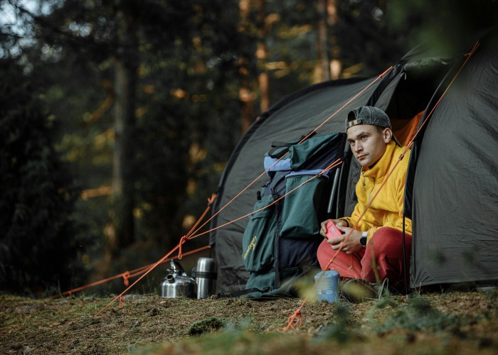
There’s something quietly powerful about stepping between rainbow-hued rhyolite mountains and black-sand deserts, past bubbling hot springs, over glacial rivers, and into lush valleys draped in moss. The Laugavegur Trail, stretching from Landmannalaugar to Þórsmörk in Iceland’s highlands, is that journey—raw, varied, and unforgettable. Laugavegur Trail Trek.
Whether you’re traveling from the USA, UK, Australia, or Germany, this guide walks you through every detail in clear, friendly language—perfect for planning your adventure without fuss.
Overview: What It Is, Where It Is, and Why It’s Famous
The Laugavegur Trail is Iceland’s most iconic multi-day trek. It begins at Landmannalaugar—known for its geothermal springs and vividly colored mountains—and leads through dramatic landscapes to Þórsmörk, a lush glacier-fed valley
Over roughly 55 kilometers (34 miles), hikers encounter colorful rhyolite hills, obsidian lava fields, steaming vents, canyons, and black sand deserts before descending into verdant woodland t has featured on National Geographic’s list of the most beautiful hikes in the world
Best Time to Visit
- Late June to Mid‑September is the prime season—huts are open and the trail is snow‑free
- Average summer daytime temperatures range between 5–12 °C (41–54 °F), with nighttime dipping to near freezing
- Attempts before late June or after mid-September carry risk: roads and huts might be closed, and the trail becomes dangerous
How to Reach the Trail (Train / Road / Air)
- Fly into Keflavík (Reykjavik region), then make your way to Landmannalaugar.
- Access requires a 4×4 vehicle or a summer bus from Reykjavik or other hubs
- On the southern end, after Þórsmörk, you can travel onward to Skógar or take a bus back to Reykjavik
Entry Fees and Permits
- There is no entry fee or permit required for the trail itself
- Mountain huts require advance booking—space fills fast
- Camping is allowed only in designated areas near huts—wild camping is not permitted
Food Availability and Meal Options
- Mountain huts offer basic facilities and sometimes snacks, but hot meals are rare, so plan accordingly
- In Landmannalaugar and Þórsmörk, limited food options exist—pack dehydrated meals, energy bars, nuts, and water. Laugavegur Trail Trek.
- Carry at least 2 L of water per day; huts usually provide drinking water
Packing List and Essentials
Clothing & Shelter
- Sturdy waterproof hiking boots
- Layered clothing (base, mid, outer shell)
- Waterproof jacket and pants
- Warm hat, gloves, and sun protection Gear & Navigation
- Backpack (50–70 L if camping)
- Map, GPS, or guidebook
- Trekking poles (helpful on river crossings)
- Headlamp, spare batteries Camping & Supplies
- Tent, sleeping bag, sleeping pad (if camping)
- Cooking gear and fuel
- First aid kit, microspikes or crampons (optional)
Safety Tips and Local Regulations
- Always start early—multi-day hikes can take 4–6 days depending on pace
- The trail is well-marked, but low visibility in fog can make navigation tricky—especially early sections
- River crossings are typically safe but can swell quickly after rain—use caution
- Download offline maps—mobile signal is patchy between huts
- Never leave the trail or your trash behind—this environment is fragile
Tips for Beginners or First-Time Visitors
- Stick to the north‑to‑south direction (Landmannalaugar to Þórsmörk)—it offers gentler downhill sections and stunning views . Laugavegur Trail Trek.
- Stay extra nights at fans like Hrafntinnusker or Þórsmörk to explore side hikes or rest.
- Consider a guided trek if unsure—resources help with weather, trail, and transport logistics
- Always check hut availability early—some hikers wait months to secure spots
Local Customs and Cultural Etiquette
- Respect the land by staying on trails and camping only in designated spots
- Be quiet in huts and campsites — peace is part of the experience.
- Leave nothing behind—take only photographs and memories
FAQ Section (High‑Search Terms for SEO)
| Question | Answer |
|---|---|
| How long is the Laugavegur Trail? | About 55 km; typically done in 4 days, sometimes 3–6 depending on pace |
| How difficult is the hike? | Moderate to challenging. Wetter weather, wading rivers, and elevation shifts add complexity |
| What is the elevation change? | Starts at ~600 m, peaks at over 1,100 m in Hrafntinnusker, then descends to ~200 m |
| Are restrooms available? | Yes, at huts only. No facilities along the trail between them. |
| Do I need a guide? | Not necessary. Trail is marked. However, beginner hikers may want guided support |
| When should I hike it? | Between June 25 and September 15, weather permitting |
| Is mobile signal available? | Very limited—mostly near huts or higher ground |
| Can children join? | Yes, if fit and prepared; shorter sections are more suitable for younger hikers. |
| Can I continue to Skógar? | Yes—via the Fimmvörðuháls pass; it’s an added day of trekking |
| What wildlife might I see? | Minimal—some birds, moss, and volcanic features. Most of the magic is geological. |
Final Thoughts
The Laugavegur Trail is a walk through contrasts—tiny ecosystems etched in stone, steam rising between cold rivers, stark lava fields melting into green valleys. For hikers from the USA, UK, Australia, Germany, and beyond, the trek is more than just exercise—it’s immersion into Iceland’s wild heart. Laugavegur Trail Trek.


Leave a Reply