The Cape to Cape Track is one of Western Australia’s most iconic coastal walks, stretching 135 km between Cape Naturaliste and Cape Leeuwin in the Margaret River region. This trek is celebrated for its breathtaking ocean views, ancient forests, wildflower trails, and pristine beaches, making it a bucket-list adventure for hikers worldwide. Cape to Cape Track, Margaret River Region, Tour & Trek.
Overview
What is the Cape to Cape Track?
- Length: 135 km (approx. 8 days for through-hikers).
- Passes through Karri and Marri forests, limestone cliffs, secluded beaches, and vineyards.
- Offers day hikes or multi-day trekking options, suitable for both beginners and experienced hikers.
Why It’s Famous
- Renowned for dramatic coastal scenery and well-maintained trails.
- Part of the Leeuwin-Naturaliste National Park, offering biodiversity and wildlife encounters.
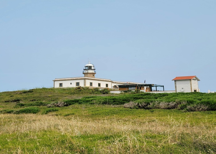
- Highlights include Canal Rocks, Sugarloaf Rock, Boranup Forest, and the Cape Leeuwin Lighthouse. Cape to Cape Track, Margaret River Region, Tour & Trek.
Best Time to Visit
- Autumn (March–May): Mild temperatures, fewer insects, ideal for trekking.
- Spring (September–November): Coastal wildflowers bloom, vibrant scenery.
- Summer (December–February): Warm, but sea breezes make shorter hikes pleasant.
- Winter (June–August): Cooler and wetter, suitable for forest sections.
Recommended months: March–May and September–November for optimal conditions.
How to Reach
By Air
- Fly into Perth Airport, then drive or shuttle to the Margaret River region.
- Regional flights are available to Busselton or Augusta for closer access.
By Road
- Well-connected highways from Perth provide access to Dunsborough, Yallingup, and Augusta trailheads.
- Car hire recommended for flexible access to sections.
By Public Transport
- Limited public transport; bus services connect towns along the route.
- Section hikers may require taxi or shuttle services.
Entry Fees and Permits
- Trail access is free, but camping at designated sites may require permits or small fees (AUD 5–20 per night).
- Respect protected areas and private property along the track.
- National park passes may be required for certain sections; check current regulations.
Food Availability and Meal Options
- Carry meals for multi-day sections; towns along the track allow for resupply.
- Recommended: dehydrated meals, trail mix, energy bars, nuts, and fresh produce.
- Key towns for resupply include Dunsborough, Yallingup, Prevelly, and Augusta.
- Always carry sufficient water; some campgrounds provide water, but treatment is recommended. Cape to Cape Track, Margaret River Region, Tour & Trek.
Packing List and Essentials
Clothing
- Lightweight, breathable layers
- Hiking pants and shorts
- Waterproof jacket and windbreaker
- Sturdy hiking boots and sandals for beach sections
- Hat, sunglasses, and sunscreen
Gear
- Backpack (30–50 liters for multi-day hikes)
- Tent or bivvy for overnight camping
- Sleeping bag suitable for seasonal temperatures
- Water purification system
- Map, compass, or GPS device
Optional
- Trekking poles for uneven terrain
- Camera for scenic and wildlife photography
- Lightweight stove for cooking
Safety Tips and Local Regulations
- Check weather conditions, especially coastal winds and tides.
- Stick to marked trails and designated camping areas.
- Respect wildlife, vegetation, and cultural sites.
- Observe fire bans and seasonal restrictions.
- Carry a first aid kit and emergency communication device.
- Inform someone of your itinerary before multi-day treks.
Tips for Beginners or First-Time Visitors
- Start with short day hikes before attempting multi-day trekking.
- Train for uneven coastal terrain and sandy paths.
- Plan resupply points and overnight stays.
- Hike with companions if possible for safety.
Local Customs and Cultural Etiquette
- The track passes through Noongar Indigenous land; respect cultural sites and heritage areas.
- Practice Leave No Trace principles to preserve natural and cultural landscapes.
- Respect private property and local communities near the trail.
Frequently Asked Questions (FAQs)
1. How long is the Cape to Cape Track?
- Total distance: 135 km, typically 8 days for through-hikers.
2. What is the difficulty level?
- Moderate, with some steep coastal sections and sandy paths.
- Suitable for beginners with preparation.
3. Are restrooms available?
- Yes, at designated campgrounds and key trailheads.
4. Can the track be completed in sections?
- Absolutely; many hikers prefer section hiking over several weekends.
5. Is water available along the track?
- Some campgrounds provide water; always carry or treat water from natural sources.
6. Are guided tours offered?
- Guided walks are available for select sections for first-time hikers.
7. Can children hike the trail?
- Yes, with adult supervision, especially on less strenuous day sections.
8. When is wildflower season?
- Spring (September–November), especially in the southwest forests.
9. Is mobile coverage reliable?
- Limited in remote sections; satellite phone or emergency beacon recommended.
10. Are dogs allowed?
- No, dogs are not permitted in national park sections.
Final Thoughts
The Cape to Cape Track is a must-experience coastal trek, offering spectacular scenery, diverse ecosystems, and a sense of adventure along Western Australia’s stunning coastline. With proper planning, attention to safety, and respect for local culture and environment, this trek promises an unforgettable outdoor experience.


Leave a Reply